 SwissHike
Sixteen of the 840, as lines.
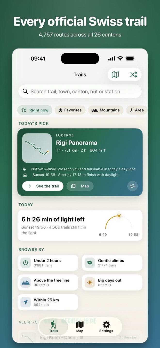
Each shape below is the real course of a route from the app's catalogue. Pick one, then tell it how you walk.
- Distance
- Ascent
- High point
How long for you?
Walking
With breaks
Water
Time = the longer of horizontal and vertical time, plus half the shorter, at 4 km/h flat, 400 m/h up and 800 m/h down (DIN 33466). The yellow sign shows the time signposted in the catalogue. Only the climb is counted on this page; the app also adds the descent from the measured profile. After three recorded hikes, the app replaces the pace you chose with the one it measured.
Which way it points.
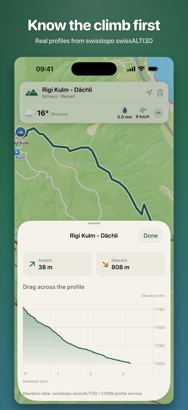
Know the climb before
Real elevation profiles from swisstopo. Drag across the profile to read any point.
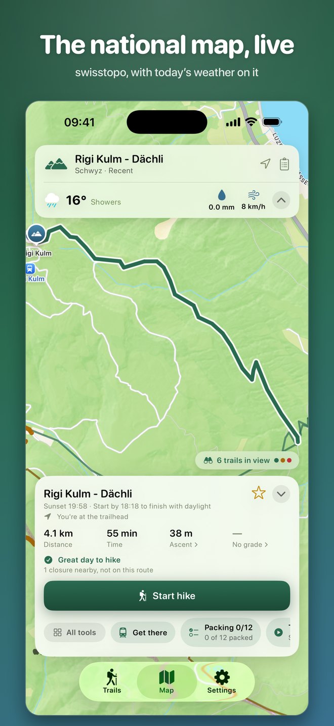
Closures & detours live
The federal list of closed hiking trails, shown on the route you are about to walk.
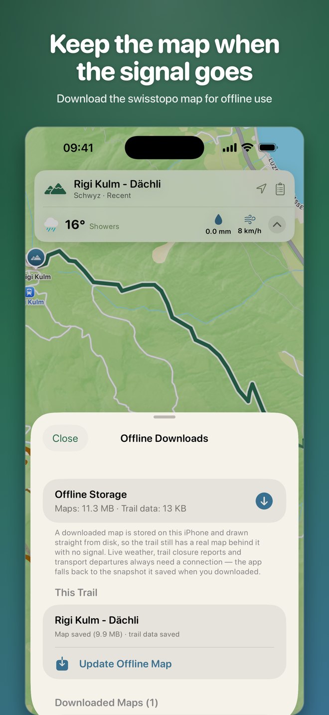
Offline no signal
Map tiles, route geometry, profiles and the last weather reading are kept on the phone.
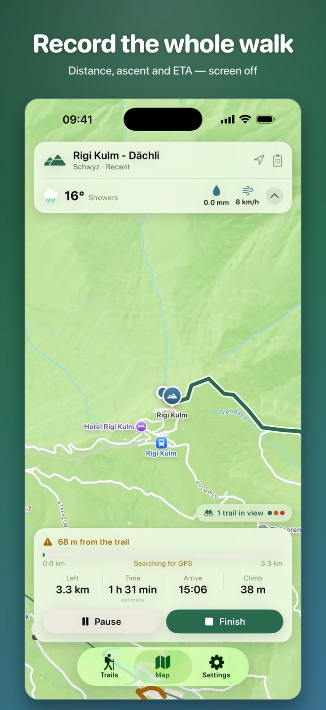
Live tracking GPS
Distance, ascent, splits and arrival time, with accuracy gating so a bad fix can't invent a climb.
SOS coordinates
Your position in WGS84 and LV95, an emergency beacon message, and the alpine distress signal.
Getting there by train
Public-transport connections to the trailhead, plus huts, water points and lift stations along the way.
Your log exportable
History, journal, photos, ratings, tags, collections, goals and badges, all exportable as one file.
Share a walk poster
Any recording becomes a poster of the line you walked. The shape of the route, never a map or coordinates.
On the trail.
It says how sure it is.
Not all trail information is equally certain, so the app labels where each figure came from instead of presenting everything alike.
officialFederal open data: swisstopo, ASTRA / SchweizMobil, published pass rules.
measuredComputed from official geometry: distances, ascent, high points.
estimateDerived by a published formula, such as walking times.
communityOpenStreetMap contributions, credited and flagged as unsurveyed.
The SAC scale, in the colours of the signs
T1Hiking trail. Well-signed, wide paths with no exposure. Suitable for anyone with basic fitness.
T2Mountain trail. Continuous but sometimes narrow path. Occasional exposure; sure-footedness helps.
T3Demanding mountain trail. Exposed sections with fall hazard, occasional use of hands.
T4–T6Alpine trails. Trail-less or scrambling sections up to sustained exposed climbing. Alpine experience essential.
Grades in the app come from OpenStreetMap tags and are shown as community data, not official SAC ratings.
The trail starts at the station.
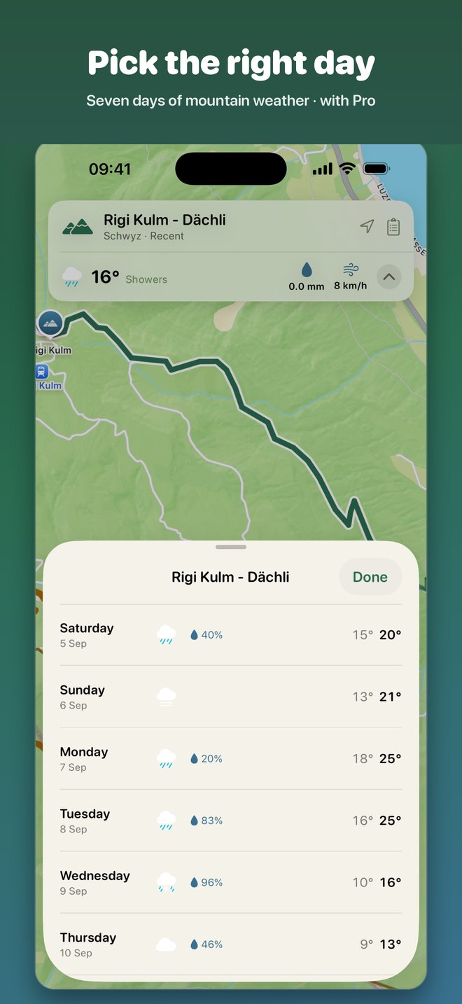
Free for iPhone and iPad, iOS 17 or later, in English, German, French and Italian. SwissHike Pro adds unlimited offline maps, 3D terrain and route flyover, the seven-day mountain forecast, a multi-day trip planner, trail comparison, peak identification and a gear optimizer.
Download on theApp Store